Titles
National Historical and Cultural City (the State Council in 1982)
National Scenic Spot (the State Council in 1982)
Cangshan Erhai National Nature Reserve (the State Council in 1994)
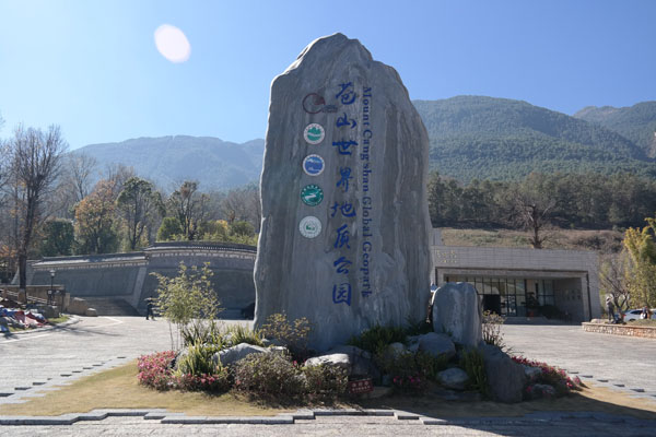
National Geopark (the Ministry of Land and Resources in September 2005)
UNESCO Global Geopark (the UNESCO 2014)
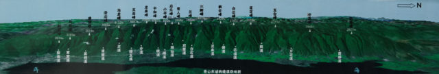
19 peaks and 18 streams of Cang MT
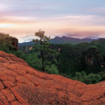
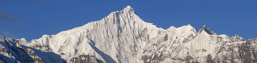
Cang Mountain or Cangshan is a mountain range immediately west of Dali City.The highest summit, Malong, is 4122 m, but the range includes another 19 peaks (all over 3500m elevation) and 18 streams.
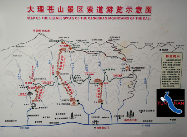
Map of Cang Mountain
Cang Mountain at the conjunction between Yunnan-Guizhou Plateau and Hengduan Mountains, is part of the southern extension of the Himalaya orogenic belt and the southern end of the Yunling Mountains. Since the magnificent Himalayas end at Mt. Cangshan, it is known as the “Eave of the Roof of the World”.
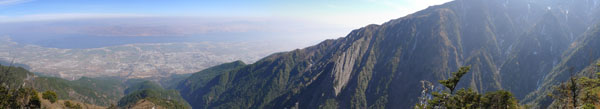
Overlooks Er Lake and Dali Ancient Town
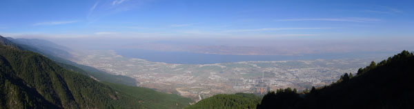
Overlooks Er Lake and Dali Ancient Town
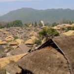
Cang Mountain Located at the southern end of the lofty Qinghai-Tibet Plateau, Mt Cangshan is a young mountain formed only 50 million years ago. But the rocks that make up the mountain are more than 2 billion years old. Mt Cangshan is mainly composed of of metamorphic rocks, including marble renowned for its beautiful colour and structure. It is the southernmost mountain in Asia reached by the latest glaciation period and many glacial landforms are well preserved and displayed. Mt Cangshan is a sacred mountain and displays unusual natural beauty. The unique and colourful traditions of the Bai indigenous people have helped make the site a popular tourist destination.
Biodiversity
The Geopark boasts rich fauna and flora resources, with Cangshan home to 9 vegetation types and 13 vegetation sub-types and 604 species of terrestrial vertebrates, and Erhai harboring 30 species of fish, 61 species of aquatic plants and 51 species of water birds.More than 170 kinds of birds and 16 kinds of national protected animals also live in the mountain.
Cang Mountain-The Sacred Mountain Of Dali
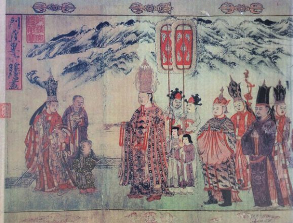
In the late Sui dynassty and early Tang dynasty,six big tribes arose in Erhai district,called the six “Zhao” in history.In 737 A.D.(the 25th year of the Kaiyuan Reign of the Tang dynasty),the Nan Zhao(Mengshe Tribe)conquered the other five tribes with the help of the Tang,unified Erhai area,and established the Nan Zhao Kingdom(738-902 A.D.).
During the Nan Zhao Kingdom,King Yi Muxun,imitated the Central Plain culture by designating “Four Rivers and Five Mountains”,among which Cang Mountain was honored as the “Central Sacred Mountain”,and it has been worshiped by local people ever since.
Wind,Flower,Snow and Moon in Dali
“Wind,Flower,Snow and Moon” is the name of an old tune in ancient China.But in Dali,it refers to four kinds of natural landscapes,namely,the wind in Xiaguan,the flowers in Shangguan,the snow on Cang Mountain,and the moon reflected in Er Lake.In the words of a popular local ballad-Stand in the wind in Xiaguan,step on the snow on Cang Mountain,enjoy the flowers in Shangguan inthe Moming,and appreciate the moon in Er Lake in the evening.
Geopark Museum
Geopark Museum is located next to “Tianlong Babu Film and TV City” in the Dali Ancient Town. The museum, with an exhibition hall area of about 3081.46 square meters includes two pavilions, with Pavilion 1 containing one floor and Pavilion 2 containing three floors partially. Seated against Mt. Cangshan, the museum has its main entrance facing Erhai Lake. The museum is a theme museum which displays the natural features and cultures & histories of the Geopark. It includes four exhibition halls: the lobby, the geology exhibition hall, the ecology exhibition hall and the culture exhibition hall.
Jade Belt Cloud Road
There is perfect hiking route which was called “Jade-Cloud Road” after the cloud formations that appear over the Cang Mountain peaks.It has 14km from Gantong chairlift station to Peach Stream.This walkway passes several waterfalls and overlooks Er Lake and Dali Ancient Town.
Expert
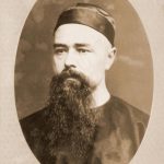
Contributor : Paris Museum of Natural History
First name(s) : Pierre Jean Marie
Last name : Delavay
Life Dates : 1834 – 1895
Specification : Plant collector